|
Mineralogical and Chemical Study of the Amarna Tablets
PROVENANCE STUDY OF THE AMARNA TABLETS From: Near Eastern Archaeology 6500 (2002): 196-205 |
|
Background of the research In the late nineteenth century, an archive of some 380 clay tablets was discovered at el-Amarna, on the east bank of the Nile about 300 kilometers south of Cairo. The majority were recovered by local farmers and sold to museums, and only a small fraction of the library was unearthed in excavations. The tablets, written in Akkadian in cuneiform script, constituted part of the diplomatic correspondence of Pharaohs Amenophis III and Amenophis IV (Akhenaten) of the fourteenth century BCE. Most of the letters were sent to Egypt from Western Asiatic states and vassal Canaanite city-states, while a minority was dispatched from Egypt to Western Asia. The "international" correspondence includes letters sent from (and to) kings of independent states like Babylonia, Assyria, Hatti, Mittani, Alashiya and Arzawa. The Canaanite correspondence includes tablets sent from (and to) rulers of city-states under direct Egyptian domination, such as Damascus, Byblos, Acco, Hazor, Shechem, Megiddo, Jerusalem, Gezer, and Ashkelon. Thirty-two tablets are school texts. Many letters are fragmentary and do not disclose the name of their writer, his city or both. Some tablets bear the name of a city, but its location is either unknown or disputed. |
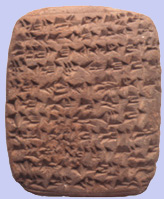 Tablet of Shuwardatu, ruler of Gath (EA 282) |
|
|
A century of textual, geographical, historical and archaeological research has clarified some of these problems. However, many issues remain unsolved and the traditional methods for identifying the place of origin of the tablets seem to have reached a stalemate.
|
||
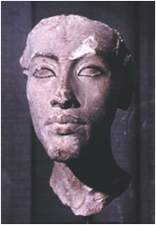 Amenophis IV (Akhenaten) (Berlin Museum) |
We propose to approach the problem of locating the provenance of the Amarna tablets from a different angle. Mineralogical and chemical analyses of over 300 clay tablets from the Amarna archive, now kept in museums in Berlin, London, Oxford and Paris, allow us to pinpoint their geographic origin and thereby clarify the geographical history of the ancient Near East.
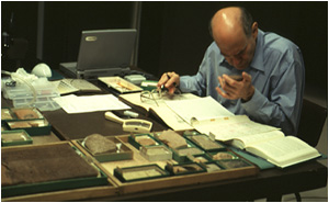
Method Modern science offers a variety of techniques for analysing the physical and chemical makeup of ceramic artefacts. The physical techniques enable us to identify the mineral composition of the clay and temper to and define the fabric of the sherd. Chemical techniques make it possible for us to measure the concentrations of the elements in the clay. In analysing ceramics, the preferable physical method is petrography; the most commonly used chemical method is Neutron Activation Analysis (NAA). Petrographic analysis of coarse, poorly fired ceramics is particularly effective, while NAA � fully quantitative and thus more precise � is generally considered more accurate for provenance determinations. Petrography is generally applied to large number of items, and the results are used to select samples for chemical analysis (Schubert 1985). Cuneiform tablet analysis must be non-destructive |
|
|
and only restricted investigative techniques can be applied. Consequently, NAA, due to the smaller sample it requires, is the most appropriate technique for cuneiform tablet analysis.
In assigning provenance to an artefact, the availability of comparative materials has a direct effect on the quality of the interpretation. Even so, the types of clay used to produce tablets are not necessarily the same as those used in the manufacture of other clay objects. This could reduce the efficacy of routine chemical procedures, which compare samples with a database containing the elemental composition of standard pottery from known sites. Petrography, on the other hand, has the advantage of being independent, since results can be interpreted on the basis of generally available, detailed geological data as well as on comparative material from investigation of pottery assemblages. For this reason, we have chosen petrography as the primary method of this research and have applied it to over 300 tablets. In order to confirm the petrographic grouping by multivariate elemental plots of 27 major, minor and trace elements, elemental (chemical) analysis was applied to 120 of these tablets. (The chemical analysis was made using Inductively Coupled Plasma Atomic Emission Spectroscopy and Mass Spectroscopy [ICP-AES/MS]). New techniques were developed in order to reduce the sample size: Scattered Petrographic Analysis was applied on complete tablets, while Peeling was used for fractured items. In Scattered Petrographic Analysis the clay and the temper are sampled separately. The tablet is first examined under a stereomicroscope to define its texture. A tiny flake of the matrix is chipped from a hidden surface using a scalpel and a representative sample of the inclusions is removed as single grains. In the laboratory, each is impregnated with thin section epoxy resin in a vacuum within a plastic mould. In the more common case of broken tablets, Peeling was applied in order to obtain larger samples. A shallow lamina was peeled off the broken facet of the tablet with a scalpel and impregnated in a plastic mould to prevent desegregation. After curing, the pellets were used for the preparation of thin-sections. Micropalaeontological study of the clay matrix was also deployed, using the foraminifera index in order to identify the age (hence the possible geological formation and origin) of the clay. Foraminifera comprise one of the main groups of the unicellular organisms Protozoa. The main bulk live in marine environments, while there are also some inland and fresh water species. Marine foraminifera are divided into two main groups, those living in the water mass (planctonic) and those living on the sea floor (bentonic). The identifications were made in the Geological Institute of Israel. In many cases they either confirmed or oriented the petrographic and chemical interpretations into a narrower range of options. The International Correspondence Prior to the application of elemental methods (see sidebar on page 201), it became mandatory to investigate whether tablets were made of clays similar to those used for pottery. Letters whose writers' location is not disputed, such as those written by the Pharaohs to foreign rulers �in other words, those deposited in the archive as copies or drafts � were selected as a case study for comparison with Egyptian ceramics. The examinations of two letters written to Babylon (El Amarna [EA] 1 and 14), two written to Amurru, a kingdom located in western Syria (EA 162 and 163), and three letters written to rulers in Canaan (EA 190, 367 and 370) disclosed that in most cases (except for EA 163) the tablets were not made from standard clays used in ancient Egypt for pottery production, namely Nile silt or marl clays (Arnold and Bourriau 1993: 149-82). Based on its mineralogical and palaeontological affinities, the clay used in the tablets corresponds with the Esna shales of Upper Egypt, particularly the Esna-Idfu region (El Naggar 1966). The use of Esna shales for pottery has not been recorded in Egypt. EA 163 is a rare example of an Egyptian letter made from typical Nile silt. The Esna shales may have been selected for this specific purpose because of their buff color and fine texture in preference to the Nile silt and markedly silty marl clays that may blur incised cuneiform signs. These results counsel that standard elemental analyses should be used with caution and tablets should be compared also with other tablets and not only with pottery. Hence we used the elemental data solely for examining the intergrouping of tablets by their element composition. Cluster and principal component analyses prove that the international letters group in agreement with their textual provenance, indicating that the international letters are originals sent from Western Asiatic kingdoms to Egypt, and not copies made in Egypt. |
||
|
The Location of Alashiya The location of the Late Bronze Age kingdom of Alashiya has been debated for a century. Textual evidence reveals that Alashiya was an autonomous entity that maintained economic and political contacts with Egypt and Syria. Its economy was based on copper production and trade with its mainland neighbors. Most scholars argue that it should be identified with the island of Cyprus and that the capital of the kingdom was located at Enkomi on the eastern coast, facing the Levant. A minority view identifies Alashiya either in Cilicia or in northwestern Syria. Four tablets sent by the king of Alashiya to the king of Egypt (EA 33, 34, 35 and 38) have previously been examined by Neutron Activation Analysis and compared with contemporary pottery from sites in Cyprus, Syria and Cilicia (Artzy, Perlman and Asaro 1976). The results suggested that the tablets were not made of eastern Cypriote clay and hence are not from Enkomi. The tablets also differ from the clay used at other major Late Bronze Age sites in Cyprus, with one exception: Certain similarities were observed between the tablets and Mycenaean IIIC sherds from Kouklia-Paiaeopciphos on the southwestern coast of the island. In the present research, we applied petrography and chemical analyses to four Alashiya letters from Amarna (EA 33, 34, 37 and 38) and to a late-thirteenth- |
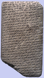 Tablet of the King of Alashiya (EA 34) |
|
|
Century-BCE letter, presumably sent from the king of Alashiya to the king of Ugarit (RS L.1, kept in the Louvre, Paris). The latter, found at Ugarit on the Syrian coast, was made of reddish clay containing poorly sorted, angular inclusions of dolerite, with additional limestone, serpentine and flint. The Amarna letters formed two main categories. One (EA 33, 34 and 38) is characterized by marl with a few calcareous and volcanic rock fragments. The other (EA 37) has a more clay-rich matrix with abundant inclusions of weathered spilitic basalt, limestone, low-grade metamorphic greywacke, quartz and flint.
The main inclusion constituents of tablets RS L.1 and EA 37 were derived from a source area consisting of basic volcanic and lesser sedimentary rocks. The compositional characteristics suggest this would have been on the margin of an ophiolite complex, where pillow-lavas and dolerite are exposed, and bordering a sedimentary area containing carbonatic, argillaceous and siliceous rocks. In the eastern Mediterranean, this description may fit the ophiolite complexes of the Troodos Mountains in Cyprus, the Mersin and Pozanti-Karsanti massifs in Cilicia, Kizildag in Hatay in southern Turkey and the Baer-Bassit massif of northwest Syria (Whitechurch, Juteau and Montigny 1984: 301-317). Significant differences in lithology and geology between these five massifs led to the conclusion that EA 37 and RS L.1 are compatible with the Troodos area of Cyprus. The Troodos ophiolite, which is remarkably well preserved, constitutes a series of pillow-lavas, dolerite and gabbro exposures. These rocks alter into fine plastic clays, some of which have been used for pottery production both within and on the periphery of the mountains (Gass et al. 1994). In the other massifs the pillow-lava and dolerite exposures are marginal in extent or nonexistent. Contact zones between sedimentary and volcanic terrains can be found around the Troodos mountains. Hence, petrographically, EA 37 and RS L.1 indicate that the suitable area should be sought inland rather than on the coast. The fresh dolerite inclusions of RS L.1 attest to a localized colluvial clay, which overlies the dolerite series of the Troodos. The origin of this tablet, therefore, must be in an area where these clays are reworked and mixed with components of the supraophiolitic sediments. This fits the inland region of southeastern Cyprus, where the prominent Late Bronze Age sites of Kalavasos-Ayios Dhimitrios in the Vasilikos Valley and Alassa-Paliotaverna in the Kouris Valley in the hilly Troodos piedmont are located. Excavations have uncovered remains of monumental buildings constructed of ashlar masonry at both these sites (South 1996, 1997; Hadjisavvas 1989; 1996). Tablet EA 37 indicates an assembly of basalts, radiolarian mudstone, flint, limestone, fine-grained, low-grade metamorphic greywacke and their derived minerals. This set of rock types corresponds to the typical clays of the Moni Melange formation on the southeastern flanks of the Troodos (Vaughan 1991). This petrofabric was found to characterize vessels at Kalavasos-Ayios Dhimitrios where a natural exposure is found just southwest of the site (Vaughan 1989: 78-81). |
||
|
Petrographic, palaeontological and chemical examinations of EA 33, 34 and 38 indicate that they were formed from the marl of the Pakhna formation that is distributed in Kouklia, Alassa and Kalavasos, but does not extend to Enkomi or the other sites that were examined in the previous Neutron Activation Analysis. Like the tablets, this marl is remarkable for its cream to buff colour, its plasticity and the hard fabric that it forms after hardening (Gass et al. 1994).
In conclusion, the political centre of Alashiya in the fourteenth-late thirteenth centuries BCE should be sought in southern Cyprus, most probably in the region of Kalavasos or Alassa. Between the two available options-the elaborate Late Bronze sites of |
 Nadav Na'aman examining tablet samples |
|
| Kalavasos-Ayios Dhimitrios and Alassa-Paliotaverna-we tend to opt for the latter. The location of Alassa halfway | ||
 Alassa-Paliotaverna |
between a region of copper mines further up the Troodos mountains and the coast is ideal for controlling and exploiting Cyprus's natural resources. In this context the literal similarity in names between Alashiya and present-day Alassa may be noted (Courtois, quoted by Hadjisavvas 1996: 23, though rejected by Karageorghis, personal communication). In any event,this location may shed light on the Ugaritic text RS 20.18, a letter sent by the chief prefect of Alashiya. The prefect warns the king of Ugarit of enemy ships that landed on his coast, but moved on without attempting to reach "the mountain". We suggest that "the mountain" may refer to the seat of the king of Alashiya, which, as we have indicated above, was located inland and thus avoided the marauding force.
|
|
|
Tunip and Amurru Amurru was a small political entity that expanded greatly during the Amarna period in the territory stretching between Tripoli on the Lebanese coast and the Middle Orontes area of western Syria (Klengel 1969: 178-299; Singer 1991). It first emerged under a certain Abdi Ashirta and his son and successor Aziru. Scholars have debated the sequence of events in the time of Aziru and the location of his seat (Singer 1990: 128-59, with earlier literature). As a result of the petrographic analysis, reconstruction of the changes in the location of Amurru's centre of government and, hence, the territorial expansion of the kingdom in the time of the Amarna correspondence, is now feasible. The early Amurru letters, written in the time of Abdi-Ashirta and in the early days of Aziru, came from two geographically close sites � the mountainous area east of Tripoli and the city of Ardata in its foothills. EA 60 and 157 originated in the mountainous area and are composed of diverse shale fragments, ferruginous to argillaceous, and by ferruginous ooliths, quartz sand and siltstone. Other indicators of this group are tuff and weathered basalt fragments. These features characterise the Lower Cretaceous clay and shales (Greenberg and Porat 1996). The Lower Cretaceous lithological section exposes widely in Mount Lebanon, along the slopes of Mount Hermon and less frequently in the Anti-Lebanon. Geologically, they are included in the Gres de Base of Lebanon (Dubertret 1949) or in the Chouf Sandstone formation (Walley 1997). This seems to validate the notion that in its early history Amurru was a small highland chiefdom located on both banks of Nahr el-Kebir, on the slopes of Mount Lebanon, and inhabited by farmers, pastoral groups and elements that had been uprooted from the urban and rural sector (Liverani 1965; Klengel 1969: 245-53; Mendenhall 1973: 130-35). To date, no significant Late Bronze Age site has been recorded here. |
||
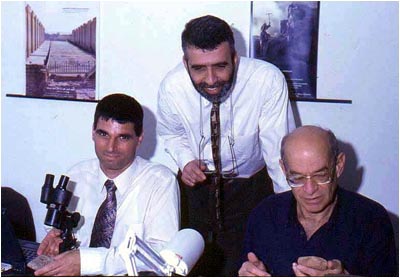 The authors: (from left) Profs. Yuval Goren, Israel Finkelstein and Nadav Na'aman |
Neogene marl typifies EA 61, 62, 156 and 159. This marl, which dates to the Miocene or the Pliocene era, is limited primarily to exposures east and south of Tripoli (Dubertret 1951). Noteworthy among them is the exposure of Nahr el-Awdeh, including the site of Tell Arde (ancient Ardata), which is the only mound of significance in the area of these exposures. It is possible to conclude, therefore, that these letters were sent from Ardata, which was located in the foothills, not too far from the Egyptian harbour-centre of Ullasa (probably modern Tripoli). We suggest that Ardata was the capital of Amurru during the later years of Abdi-Ashirta and the early years of Aziru (for the site of Arde/Ardata, see Salame-Sarkis 1973).
|
|
|
Another group of Amurru tablets (EA 161, 164 and 169-171) features marl with foraminifers of Neogene to recent age. The inclusions are primarily igneous, usually basalt and only rarely dolerite, together with limestone and some quartz. This lithological combination is limited to the inland part of the Akkar Plain, where Pliocene marine deposits and volcanics appear jointly, specifically near Halba in the south and to the north of Nahr el-Kebir. Tell Arqa (ancient Irqata) is the only significant site in this area. After Aziru consolidated his reign, it appears that he relocated his capital to this city.
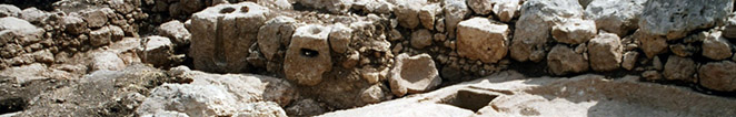
Thin sections of Amurru and Canaanite tablets, all under crossed polarizers, green bar size: 0.2 mm. A) EA 59: glauconite pellets (green spheres) and chalk (white bodies) in foraminiferous marl. B) Coralline alga (Amphiroa sp. algae) in EA 167. C) Partly chloritized spilite (left, centre) in EA 259. D) Jordan sand in EA 249 including basalt (left, centre), chalk (right, centre) and quartz (not in this field). Three of Aziru's letters (EA 165-167) contain Pleistocene to Holocene coastal sediments dominated by the coralline algae Amphiroa sp. algae, flint and igneous basic minerals (such as serpentine and olivine). A coastal origin for these tablets can confidently be assumed. The only place where Pleistocene-Holocene beach deposits, Senonian or Eocene flint and basic minerals appear together is the coastal area of the Akkar Plain (Sanlaville 1977). The mafic minerals were probably transported there from the basalts of Nahr el-Kebir. In this general area Tell Kazel, an eight-hectare mound, is the only significant Late Bronze Age site (Badre et al. 1994). It is generally identified with Sumur, an Egyptian administrative centre on the northern coast of Canaan, which was captured and held by Aziru (Klengel 1992: 160-74). Evidently, Aziru sent the three letters after he had captured the town, located not too far west of Irqata (contra Singer 1990: 138; 1991: 152, who proposed that they were sent from Tunip). In sum, the petrographic analysis enables us to establish the development of Amurru from a small entity centered in the mountainous area east of Tripoli to a large territorial kingdom with a capital near the coast. A cardinal problem related to the correspondence of Amurru is the identification of the city of Tunip mentioned in four letters sent by Aziru (EA 161 and 165-167), in a letter sent by the citizens of Tunip (EA 59), and in other second-millennium-BCE documents (see Astour 1969: 390-98; 1977; Klengel 1969: 75-95). Aziru's letters indicate that Tunip was annexed to his territory during his reign. This important city was sought either in northern Phoenicia (Helck 1973) or in the Middle Orontes. Two prominent sites have been suggested in the latter region: Tell Hama in the modern city of Hama (Astour 1977) and Tell Asharneh in the southern Ghab Valley northwest of Hama (Klengel 1995). EA 59, a letter sent by "the citizens of Tunip" to the Pharaoh, is made of foraminiferous marl dominated by abundant glauconite spheres, which were probably derived from the marl that appear with it. The palaeontological evidence links it to the Paleogene age. It is commonly accepted that glauconite is formed by marine diagenesis of materials in shallow water at a time of slow sedimentation. Although glauconite concentrations may be found as impurities in limestones and marls, when they appear in high proportions they form greensands, a term coined after the green colour of the mineral. Since glauconite is a potential substance for assessing an age for geologic strata through potassium-argon dating, there is a rich body of data regarding its distribution in the Paleogene sequence of Syria (Krasheninnikov et al. 1996, with references). Glauconite sediments are found there in restricted areas, in the Palmyrids depression, the southern slopes of the Halab uplift, the western slopes of Jebel Anseriyeh, and much more seldom on the eastern slopes of the Anti-Lebanon. Yet, according to the textual evidence, these areas are irrelevant for the location of Tunip. Redeposited Senonian and Paleogene glauconite beds are reported also from the Pliocene continental deposits that fill the Ghab basin and the margins of the Asharneh Valley (Shatsky et al. 1966: 54-56), an area which fits the textual references to the location of Tunip. The only prominent second-millennium site in this area is Tell Asharneh, a 70-hectare site on the Orontes river (Courtois 1973: 63-65). Current petrographic study of pottery from Tell Asharneh (Cooper and Fortin in press) reveals that one of the main local petrofabrics is distinguished by the presence of glauconite in considerable quantities. We therefore support the identification of Tunip with Tell Asharneh. The Egyptian Administration in Canaan In the Late Bronze Age, Canaan was an Egyptian province governed by Egyptian administrators and garrison forces stationed in a few centres located outside the system of Canaanite city-states. In the Amarna period these centres were Gaza, Jaffa, Ullasa and Sumur on the coast, and Beth-Shean and Kumidi inland. Letters from securely identified cities in Canaan, such as Byblos, Tyre, Hazor, Megiddo, Shechem, Jerusalem and Gath have, in most cases, a mineralogical and lithological composition that is in agreement with their geological environment. As opposed to the international letters, in most cases the clays used were identical to those utilized for pottery production at these sites. However, some letters from Canaanite city-states were made from raw materials that do not fit their location. These tablets are clustered in two groups. The first includes some of the letters from Gezer, a letter from Beirut, and letters from a few rulers whose seat is unknown. These tablets were made from loess and sand from the southern coastal plain. The second group, which includes tablets from Jerusalem, Shimon (Amarna's Shamhuna in the northwestern Jezreel Valley) and Acco, contains marl and sand with basalts, flint, limestone, travertine, quartz and occasionally phosphorite and pisoliths. These are all characteristic of the central Jordan Valley sediments. The two groups also cluster chemically. The loessial group is distinguishable from other loessial tablets produced at southern Canaanite cities such as Lachish, Gath, Ashkelon and Yurza. |
||
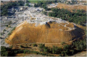 Beth Shean |
Historical sources in the case of Gaza (Ahituv 1984: 97-98; Redford 1990: 32-33) and archaeological finds in the case of Beth-Shean (James 1966; Mazar 1993) indicate that these were prominent centres in the Egyptian administration system in Canaan. The only explanation for the above phenomenon is that these letters were indeed written by Canaanite rulers but sent from Gaza (the loessial group) and Beth-Shean (the Jordan Valley sediments). The texts do not provide any clue as to why these specific tablets were sent from the Egyptian bases, but we suggest that Canaanite rulers appeared before the Egyptian officials from time to time and on those occasions dispatched letters which deal with the issues at hand.
|
|
|
The Location of Three North Palestinian Rulers
The hometowns of several Canaanite participants in the Amarna correspondence are either not mentioned in their letters or not identified with certainty. As an example, we wish to present the problem of three north Palestinian rulers who are connected, at least geographically. They are Ba'lu-UR.SAG, Ba'lu-mehir and Tagi. Rainey suggested identifying Ba'lu-UR.SAG ("UR.SAG" is a Sumerian logogram whose decipherment in the Akkadian of the Amarna letters is uncertain) with Ba'lu-mehir ("mehir" is a West Semitic noun meaning "warrior"). Other scholars regarded them as two separate rulers and rejected this proposal (Na'aman 1975: 33-34; Moran 1992: 310; Liverani 1998: 121-22). The petrographic study of the tablets indicates that they did indeed rule in different areas. A letter of Ba'lu-UR.SAG (EA 249) is characterized by marly clay and an inclusion assemblage containing limestone, olivine basalt, flint, quartz, travertine and aquatic mollusk shell fragments. This composition is typical of the alluvial sand of the Jordan river south of Beth-shean. Therefore, this letter could have been sent either from the Egyptian centre at Beth-shean, or from Rehob (identified with the large mound of Tell es-Sarem/Tel Rehov; Mazar 1999), a nearby Canaanite city-state mentioned in several Late Bronze Age documents (Ahituv 1984: 164-65). Locating Ba'lu-UR.SAG in the Beth-Shean Valley is plausible since it places him near the "theater of operations" of the southern Jezreel Valley (especially the town of Shunama, Shunem of Josh 19:18, identified with the village of Sulem located southeast of Afula) referred to in his second letter (EA 250: 43). Moreover, locating him at Rehob fills a gap in the Canaanite city-state system: No other city is mentioned in the central Jordan Valley and Rehob is mentioned as a capital of a city-state in other Late Bronze Age sources. It has been suggested that Gitti-padalla (EA 250: 9-14) was his capital (Rainey 1968), but it seems to have been only a minor town within his territory, probably located somewhere in the Beth-Shean Valley. The three tablets sent by Ba'lu-mehir (EA 257-259) are characterized by alluvial clay with inclusions of chalk, spilitic basalt, tuff and travertine. The only location in the Levant where these components may possibly meet is Mount Carmel, where Late Cretaceous pyroclastic volcanoes typified by tuff deposits were identified (Sass 1980). In addition to tuffs, the inclusions contain basalts and hence an |
||
|
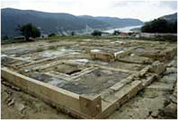
area with basaltic flows should exist near the place where the tablets were written. Such outcrops appear only in two places on the southern flank of Mount Carmel. The prominent Late Bronze Age site of Tel Yokneam is situated only two kilometers away from one of these basalt flows, which is drained into the Jezreel Valley at the foot of the mound. Furthermore, the common petrographic group of the Iron Age I-II assemblages unearthed at the site was found to be identical with that of the tablets. Since the unique composition of the inclusions was not encountered in any other ceramic assemblage in Israel, it is obvious that Tel Yokneam should be considered the best candidate for the city where Ba'lu-mehir ruled.
|
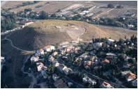 Tel Yokneam |
|
|
It seems that Ba'lu-mehir's capital was called [x-x-i]G-ma-te (EA 257: 21). This may have been the Bronze Age name of biblical Jokneam. The relation of this name to the Late Bronze Age toponym 'En-qn'mu, mentioned in the topographical list of Thutmose III (Ahituv 1984: 123), remains unclear.
Tagi was the ruler of a place named Ginti-kirmil (EA 289: 18-20). Two suggestions were raised for its location, each interpreting the component 'kirmil' in the city's name differently. According to one, the city should be looked for near the Carmel Ridge (e.g., Alt 1925: 48 n. 3). The second maintains that 'carmel' should be simply understood as a noun meaning plantation or garden-land, and that the city may be located anywhere in Canaan (Aharoni 1969: 141-145). Three letters of Tagi were examined (EA 264-266). Petrographically, they are characterized by marl typical of the Taqiye formation (Ben-Tor 1966: 72-73) with chalk inclusions. This composition is unlikely to be found cither in the southwestern part of the country (an area proposed for the location of Tagi by Aharoni 1969) or along the Carmel coast. However, it fits the vicinity of the massive mound of the village of Jatt in the Sharon, whose identification with Ginti-kirmil was suggested many years ago by Alt (1925: 48, n. 3; see Jirku 1930: 143; Helck 1971: 185 and n. 115) but later rejected (Albright 1946; Rainey 1968). The name of the village preserves the component Ginti in the name of Tagi's city, and the mound is located not far from the southern slopes of Mount Carmel. Jatt is strategically situated, dominating the international road that led from Egypt via the coastal plain of Canaan to Syria and the north. Solving the riddle of the location of Ba'lu-UR.SAG, Ba'lu-mehir and Tagi helps to decipher the overall geographic disposition of the north Canaanite city-states in the Late Bronze Age. A Final Word Mineralogical and chemical studies of clay tablets may resolve historical problems that have haunted research for decades. In the case of the Amarna archive, the introduction of this scientific tool helps to clear up the controversy over the location of Alashiya and Tunip, opens the way to track the territorial expansion of the kingdom of Amurru, enables reconstruction of the territorial disposition of the Canaanite city-states of the Late Bronze Age and sheds light on the Egyptian administration system in Canaan. The method described here should be applied in other cases. It may serve to establish the location of cities and states mentioned in tablets retrieved in other areas of the ancient Near East and beyond, and dated to other periods. It may also help to elucidate the origin of tablets of unspecified provenance that appear in many collections. In each case, if possible, the mineralogical data should be correlated with information provided by the text and the archeological evidence from the site or region involved. The combination of the three disciplines is the key to successful research of this type. Notes We wish to thank B. Salje and J. Marzahn from the Vorderasiatisches Museum in Berlin, J. Curtis, S. Bowman, C. Walker and A. Middleton from the British Museum, P.R.S. Moorey from the Ashmolean Museum, A. Caubet and B. Andre-Salvini from the Musee de Louvre for their invaluable help. The ICP analyses and the micropalaeontological identifications were made in the Geological Survey of Israel. This study was supported by the Center for Collaboration between Natural Sciences and Archaeology of the Weizmann Institute of Science, and the Fund for Internal Researches of the Tel Aviv University. We thank E. Cooper, I. Freestone, S. Gassner, D. Griffiths, L. Grossowitz, S. Hadjisavvas, M. Huges, G. Konstantinou, A. Middleton, N. Porat, I. Segal, A. Shimron, L. Smith, A. South, J.-P. Thalmann and S. Vaughan for their useful advise on specific topics discussed in this article. Those who would identify Alashiya with Cyprus include Holms (1971), Muhly (1972; 1989; 1996) and Knapp (1985; 1996). For the minority view, see the reviews of the evidence in Hellbing (1979) and especially Merrillees (1987). Most scholars follow the hypothesis of Nougayrol et al. (1968: 86, n. 1, 695-697), that RS L.1 had been sent from Alashiya and was responded by letter 20.238 of Ammurapi, King of Ugarit. A minority of scholars opposes this view. Singer (1983: 217; 1999: 720, n. 394) and Yamada (1992: 438-450) suggested that RS L.1 must have been sent by the King of Carchemish, the overlord of Ugarit at the time of Ammurapi. This view has recently been adopted by Malbran-Labat (1999: 122) and Yon (1999: 118). Yet, petrographically this tablet is incompatible with the geology of Carchemish in particular and the Upper Euphrates area in general. Moreover, a letter from the King of Carchemish to Ugarit (RS 8.333), examined by us, is entirely different in composition and suits the geology of the Carchemish area. The Carchemish hypothesis should therefore be discarded. Ophiolites are complexes of basic and ultrabasic lavas and minor intrusions associated with the uplifting of mid-oceanic ridges. References Aharoni, Y. 1969 Rubute and Ginti-kirmil. Vetus Testamentum 19: 141-144. Ahituv, S. 1984 Canaanite Toponyms in Ancient Egyptian Documents. Jerusalem: Magnes. Albright, W. F. 1946 The Late Bronze Town at Modern Djett. Bulletin of the American Schools of Oriental Research 104: 25-26. Alt, A. 1926 Das Institut im Jahre 1925. Palastinajahrbuch 22: 5-80. Artzy, M.; Perlman, I.; and Asaro, F. 1976 Alasiya of the Amarna Letters. Journal of Near Eastern Studies 2: 171-182. Astour, M. 1969 The Partition of the Confederacy of Mukish-Nuhashshe-Nii by Suppiluliuma. A Study in Political Geography of the Amarna Age. Orientalia 38: 381-414. Astour, M. 1977 Tunip-Hamath and Its Region, a Contribution to the Historical Geography of Central Syria. Orientalia 46: 51-64. Arnold, D. and Bourriau, J., eds. 1993 An Introduction to Ancient Egyptian Pottery. Mainz: von Zabern. Badre, L.; Gubel, E.; Capet, E.; and Panayot, N. 1994 Tell Kazel (Syrie), Rapport preliminaire sur les 4e-8e campagnes de fouilles (1988-1992). Syria 71: 259-346. Bentor, Y. K. 1966 The Clays of Israel. Jerusalem: The International Clay Conference. Cooper, E. and Fortin, M. In press Petrographic Analysis of Bronze and Iron Age Pottery from Tell 'Acharneh, Syria. In Proceedings of the CELAT 1999 Archaeometric Workshop, edited by M. Fortin. Laval University, Quebec: Les Cahiers archeologiques du Celat. Courtois, J.-C. 1973 Prospection archeologique dans la moyenne vallee de l'Oronte. Syria 50: 53-99. Dubertret, E. 1949 Carte geologique au 200.000e. Feuille de Tripoli. Beyrouth: Service de travaux publiques. Dubertret, E. 1951 Carte geologique au 50.000e. Feuille de Tripoli. Beyrouth: Service de travaux publiques. Gass, I. G.; MacEeod, C. J.; Murton, B. J.; Panayotou, A.; Simonian, K. O.; and Xenophontos, C. 1994 The Geology of the Southern Troodos Transform Fault Zone. Nicosia: Cyprus Geological Survey Department (Memoir No. 9). Greenberg, R. and Porat, N. 1996 A Third Millennium Levantine Pottery Production Center: Typology, Petrography, and Provenance of the Metallic Ware of Northern Israel and Adjacent Regions. Bulletin of the American Schools of Oriental Research 301: 5-24. Hadjisavvas, S. 1989 A Late Cypriote Community at Alassa. Pp. 32-42 in Early Society in Cyprus, edited by E. Peltenberg. Edinburgh: Edinburgh University. Hadjisavvas, S. 1996 Alassa: A Regional Center of Alasia? Pp. 23-38 in Late Bronze Age Settlement in Cyprus: Function and Relationship, edited by P. Astrom and E. Herscher. Studies in Mediterranean Archaeology and Literature Pocket-Book 126. Jonsered: Astroms. Helck, W. 1971 Die Beziehungen Aegyptens zu Vorderasien im 3. und 2. Jahrtausend v. Chr. Wiesbaden: Harrassowitz. Helck, W. 1973 Die Lage der Stadt Tunip. Ugarit-Forschungen 5: 286-288. Hellbing, L. 1979 Alasia Problems. Studies in Mediterranean Archaeology, 57. Goteborg: Astroms. Holms, Y. L. 1971 The Location of Alashiya. Journal of the American Oriental Society 91: 426-429. James, F. 1966 The Iron Age at Beth Shan: A Study of Levels VI-IV. Philadelphia: The University Museum. Jirku, A. 1930 Durch Palastina und Syrien. Bericht uber eine Forschungsreise in Fruehjahr. Zeitschrift des Deutschen Pal?stina-Vereins 53: 136-166. Kiengel, H. 1969 Geschichte Syriens im 2. Jahrtausend v.u.Z., II. Berlin: Akademie. Kiengel, H. 1992 Syria 3000 to 300 B.C., A Handbook of Political History. Berlin: Akademie. Kiengel, H. 1995 Tunip und undere Probleme der historischen Geographie Mittelsyriens. Pp. 125-134 in Immigration and Emigration within the Ancient Near East, edited by K. van Lerberghe and A. Schoors. Leuven: Peeters. Knapp, A. B. 1985 Alashiya, Caphtor/Keftiu and Eastern Mediterranean Trade: Recent Studies in Cypriote Archaeology and History. Journal of Field Archaeology 12: 231-250. Knapp, A. B. (ed.) 1996 Sources for the History of Cyprus Vol. II, Near Eastern and Aegean Texts from the Third to the First Millennia BC. Altamont, NY: Greece and Cyprus Research Center. Knudtzon, J. A. 1915 Die el-Amarna Tafeln. Leipzig: Hinrichs. Krasheninnikov, V. A.; Golovin, D. I.; and Miravyov, V. I. 1996 The Paleogene of Syria-Stratigraphy, Lithology, Geochronology (Geologisches Jahrbuch 86). Hannover: Andlung. Liverani, M. 1965 Implicazioni sociali nella politica di Abdi-Ashirta di Amurru. Rivista degli studi orientali 40: 267-277. Liverani, M. 1998 Le lettere si el-Amarna 1-2. Brescia: Paideia. Malbran-Labat, F. 1999 Nouvelles donees epigraphiques sur Chypre et Ougarit. Report of the Department of Antiquities Cyprus 1999: 121-123. Mazar, A. 1993 Beth Shean in the Iron Age: Preliminary Report and Conclusions of the Mazar, A. 1990-1991 Excavations. Israel Exploration Journal 43: 201-229. Mazar, A. 1999 The 1997-1998 Excavations at Tel Rehov: Preliminary Report. Israel Exploration Journal 49: 1-42. Mendenhall, G. E. 1973 The Tenth Generation. Baltimore: The Johns Hopkins University. Merrillees, R. S. 1987 Alashiya Revisited. Cahiers de la Revue Biblique, 22. Paris: J. Gabalda. Moran, W. L. 1992 The Amarna Letters. Baltimore: The Johns Hopkins University. Muhly, J. D. 1972 The Land of Alashiya. References to Alashiya in the Texts of the Second Millennium BC and the History of Cyprus in the Late Bronze Age. Pp. 201-19 in Acts of the First International Cyprological Congress, edited by V. Karageorghis. Nicosia. Muhly, J. D. 1989 The Organization of the Copper Industry in Late Bronze Age Cyprus. Pp. 298-314 in Early Society in Cyprus, edited by E. J. Peltenburg. Edinburgh: Edinburgh University. Muhly, J. D. 1994 The Significance of Metals in the Late Bronze Age Economy of Cyprus. Pp. 45-59 in The Development of the Cypriot Economy from the Prehistoric Period to the Present Day, edited by V. Karageorghis and D. Michalides. Nicosia: University of Cyprus. Na'aman, N. 1975 The Political Disposition and Historical Development of Eretz-Israel according to the Amarna Letters. Unpublished Ph.D thesis, Tel Aviv University (Hebrew with English abstract). Na'aman, N. 1981 Economic Aspects of the Egyptian Occupation of Canaan. Israel Exploration Journal 31: 172-185. Naggar, Z. R. el-. 1965 Stratigraphy and Classification of Type Esna Group of Egypt. Bulletin of the American Association of Petroleum Geologists 50: 1455-1477. Nougayrol, J.; Laroche, E.; Virolleaud, C.; and Schaeffer, F. A. 1968 Ugaritica V, nouveaux textes accadiens, hourrites et ugaritiques des archives et bibliotheques privees d'Ugarit, commentaires des textes historiques (premiere partie). Paris: Librairies orientaliste P. Geuthner. Rainey, A. F. 1968 Gitti-padalla. Israel Exploration Journal 18: 1-14. Redford, D. B. 1990 Egypt and Canaan in the New Kingdom. Beer-Sheva IV. Beersheva: Ben Gurion University. Salame-Sarkis, H. 1973 Chronique archeologique du Liban-Nord. Bulletin du Musee de Beyrouth 26: 91-102. Sanlaville, P. 1977 Etude Geomorphologique de la Region Littorale du Liban. Beirouth: Publications de l'Universite Libanaise. Sass, E. 1980 Late Cretaceous Volcanism in Mount Carmel, Israel. Israel Journal of Earth-Sciences 29: 8-24. Schubert, P. 1986 Petrographic Modal Analysis - A Necessary Complement to Chemical Analysis of Ceramic Coarse Ware. Archaeometry 28: 163-178. Shatsky, V. N.; Kazima, V .G.; and Kulakov, V. V. 1966 The Geological Map of Syria, Scale 1: 200,000, Sheets I-37-XIX, I-36,XXIV, Explanatory Notes. Damascus: Ministry of Industry. Singer, I. 1983 Western Anatolia in the Thirteenth Century B.C. according to the Hittite Sources. Anatolian Studies 33: 205-217. Singer, I. 1990 Aziru's Apostasy and the Historical Setting of the General's Letter. Pp. 113-183 in The General's Letter from Ugarit. A Linguistic and Historical Reevaluation of RS 20.33, by S. Izre'el and I. Singer. Tel Aviv: Tel Aviv University. South, A. 1996 Kalavasos-Ayios Dhimitrios and the Organisation of Late Bronze Age Cyprus. Pp. 39-49 in Late Bronze Age Settlement in Cyprus: Function and Relationship, edited by P. Astrom and E. Herscher. Jonsered: Astroms. South, A. 1997 Kalavasos-Ayios Dhimitrios 1992-1996. Report of the Department of Antiquities Cyprus 1997: 151-175. Vaughan, S. 1989 Petrographic and Microprobe Analyses of Base Ring Ware. Pp. 78-81 in Vasilikos Valley Project 3: Kalavasos-Ayios Dhimitrios II Ceramics, Objects, Tombs, Specialist Studies (Studies in Mediterranean Archaeology 81: 3), edited by A. South, P. A. Russell and P. S. Keswani. Goteborg: Astroms. Vaughan, S. 1991 Late Cypriote Base Ring Wares: Studies in Raw Materials and Technology. Pp. 337-368 in Recent Developments in Ceramic Petrology (British Museum Occasional Paper 81), edited by A. Middleton and I. Freestone. London: The British Museum. Walley, C. 1997 The Lithostratigraphy of Lebanon: A Review. Lebanese Science Bulletin 10: 81-108. Whitechurch, H.; Juteau, T.; and Montigny, R. 1984 Role of Eastern Mediterranean Ophiolites (Turkey, Syria, Cyprus) in the History of the Neo-Tethys. Pp. 301-317 in The Geological Evolution of the Eastern Mediterranean, edited by J. E. Dixon and A. H. F. Robertson. Oxford: Blackwell/The Geological Society. Yamada, M. 1992 Reconsidering the Letters from the "King" in the Ugarit Texts: Royal Correspondence of Carchemish? Ugarit-Forschungen 24: 431-446. Yon, M. 1999 Chypre et Ougarit a la fin du Bronze Recent. Report of the Department of Antiquities Cyprus 1999: 113-118. |
||